Urban Forecast
Urban Forecast was part of my Masters Thesis project presented in 2013. This project was motivated by the drug war violence happening in parts Mexico where most of my family currently lives.
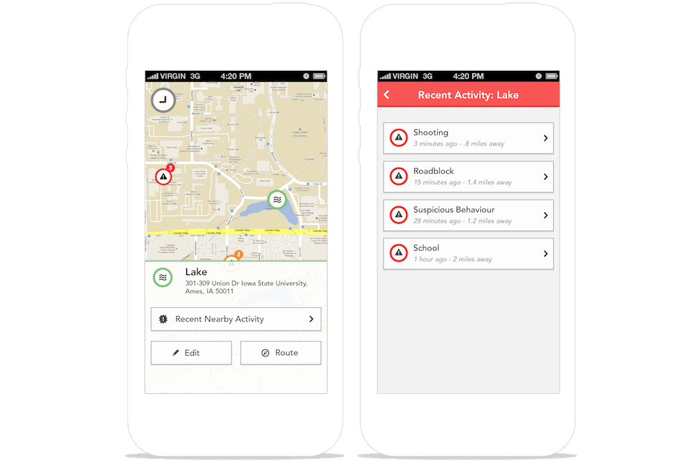
People currently living in affected areas use social media channels like Twitter to gather information about dangerous situations happening around them. They use text-based software for visual information. Urban Forecast is a solution focused on facilitating the spread of crisis information by using the public as the source.
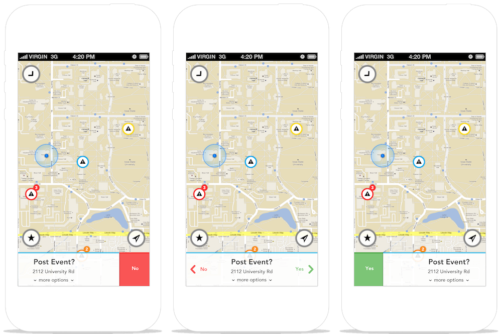
Urban Forecast allows users to post a crisis event on a map that all users can interact with. The use of mobile gestures expedites the posting process enabling people to use the app even during a crisis.
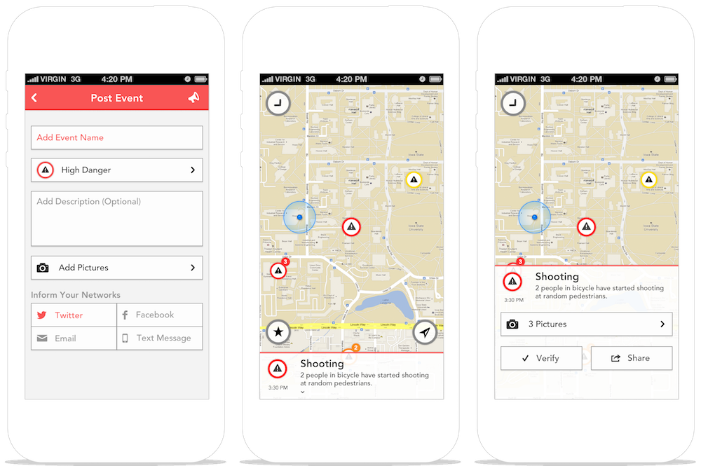
Posts can be shared through various social media networks to facilitate the spread of information further. Every event added can be verified as true or false by any other user to increase accuracy through community participation.
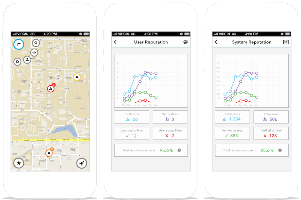
All the information is saved and evaluated to give the system an accuracy reputation to keep it as transparent as possible with the assumption that transparency establishes trust. Each user can only see their reputation to help users feel comfortable when posting crisis information.
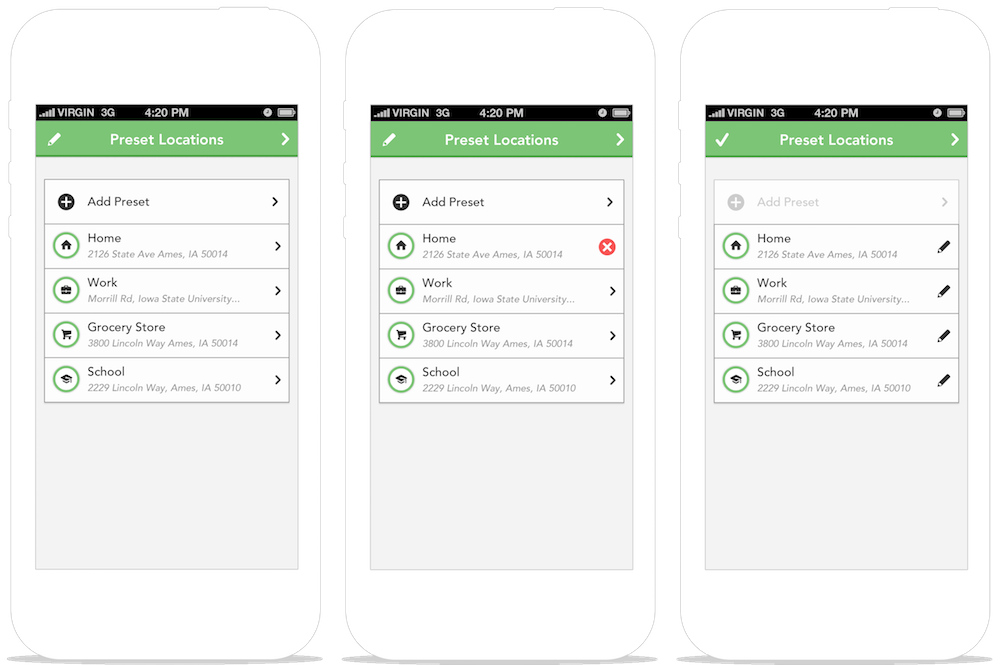
Preset locations can be added to help the user check the areas that are most important to him/her.